")
In the previous project, three different types of desert investigation and observation sites in the lower reaches of Heihe River were set up. Different kinds of desert plants with the same average growth and size as the observation site were selected for the above ground biomass and underground biomass total root survey. The dry weight was the dry weight at 80 ℃, and the root shoot ratio was the dry weight ratio of the underground biomass to the aboveground biomass. Species: Elaeagnus angustifolia, red sand, black fruit wolfberry, bubble thorn, bitter beans, Peganum, Tamarix and so on.
SU Peixi
")
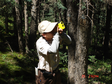
The EC150 open circuit eddy covariance observation system was set up in the typical Populus euphratica community near ulantuge of Ejina oasis in the lower reaches of Heihe River. The water and heat fluxes of Populus euphratica community from July 2013 to September 2014 were systematically observed.
CHEN Yaning
")
1) Initial data of community characteristics and main plant biological characteristics of the grass-animal equilibrium stage of the test grassland in 1983; 2) Livestock management data of 4-5 grazing grasslands; 3) Observation data of diversity, productivity and functional group of different grazing grassland communities; 4) Observation data on the height, coverage, biomass, and flower morphology, tillering, and leaf characteristics of main plants in different grazing gradient grasslands 5) Observation data of soil nutrients and litter in different grazing grasslands.
ZHAO Chengzhang
")
GIMMS (glaobal inventory modelling and mapping studies) NDVI data is the latest global vegetation index change data released by NASA C-J-Tucker and others in November 2003. This dataset is a long-term GIMMS vegetation index dataset of the Qinghai Lake Basin, which includes changes in the vegetation index from 1981 to 2006. The time resolution is 15 days and the spatial resolution is 8 km. GIMMS NDVI data recorded the changes of vegetation in 22a area in the format of satellite data.
National Aeronautics and Space Administration
")
The data set contains the observation data of thermal diffusion fluid flow meters at the downstream mixed forest station and eupoplar forest station of the hydrometeorological observation network from January 1 to December 31, 2014. La shan au in the study area is located in the Inner Mongolia autonomous region of mesozoic-cenozoic in iminqak, according to the different height and diameter at breast height of iminqak, choose sampling tree installation TDP (Thermal Dissipation SAP flow velocity Probe, Thermal diffusion flow meter), domestic TDP pin type Thermal diffusion stem flow meter, the model for TDP30.The sample sites are TDP1 point and TDP2 point respectively, which are located near the mixed forest station and populus populus station.The height of the sample tree is TDP2 and TDP1 from high to low, and the diameter of the chest is TDP1 and TDP2 from large to small, so as to measure the trunk fluid flow on behalf of the whole area.The installation height of the probe is 1.3 meters and the installation orientation is due east and west of the sample tree. The original observation data of TDP is the temperature difference between probes, which is collected once for 10s and the average output period is 10 minutes.The published data are calculated and processed trunk flow data, including flow rate (cm/h), flux (cm3/h) and daily transpiration (mm/d) per 10 minutes.Firstly, the liquid flow rate and liquid flux were calculated according to the temperature difference between the probes, and then the transpiration Q per unit area of the forest zone was calculated according to the area of Euphrates poplar forest and the distance between trees at the observation points.At the same time, post-processing was carried out on the calculated rate and flux value :(1) data that obviously exceeded the physical significance or the instrument range were removed;(2) the missing data is marked with -6999;Among them, the data of TDP2 was missing due to power supply problems from 1.1-2.8 days, and the data of the third group of probes was missing from 2.8-3.13 days due to the problems of the third group of probes.(3) suspicious data caused by probe fault or other reasons shall be identified in red, and the data confirmed to have problems shall be removed. Please refer to Li et al.(2013) for hydrometeorological network or site information, and Qiao et al.(2015) for observation data processing.
LIU Shaomin, LI Xin, CHE Tao, XU Ziwei, REN Zhiguo, TAN Junlei
")
The vegetation regulation mechanism project of soil water cycle in arid desert areas belongs to the national natural science foundation "environment and ecological science in western China" major research plan, led by li xinrong, a researcher of the institute of environment and engineering in dry and cold areas, Chinese academy of sciences, with the running time of 2003.1-2005.12. Remittance data of the project: 1. Dataset of observation field of shapotou railway vegetation sand fixation protection system (excel) Plant and soil information in the vegetation-sand fixation zone established in 1956, 1964, 1981 and 1987.Since the establishment of the observation field, long-term soil moisture and vegetation surveys have been conducted. This database records the soil moisture data after the neutron tube installation in August 2002, the vegetation data from 2003 to 2005 (vegetation structure, herb structure, shrub structure, etc.), and the soil physical and chemical properties data (particle size, total N,P2O5,K2O, hydrolyzed N) of the irregular surveys. 2. Physiological data set of desert plant stress (excel) From 2003 to 2005, the physiological and biochemical characteristics of typical plant communities and their dominant species in steppe desert under natural and simulated environmental conditions were analyzed.(including photosynthetic transpiration, fluorescence, biochemistry and other indicators) 3. Soil infiltration and evapotranspiration data set (excel) Precipitation infiltration process, soil water dynamics and evapotranspiration of fixed sand dunes monitored by desert artificial vegetation using TDR and Lysimeters from 2002 to 2005. 4. Data set of comprehensive survey on soil and vegetation in the southeastern margin of tengger desert (excel) In 2003-2004, silver (sichuan), yan (latour) highway, silver (sichuan) (state) highway through the tengger desert area, set up along the road of eight samples, 449 samples of soil conductivity, Ph, organic matter, total nitrogen (content) and vegetation (plants, coverage, average height, biomass, strains, coverage, high average, biomass).
LI Xinrong

Photosynthesis of Populus euphratica is mainly affected by atmospheric CO2 concentration, intercellular CO2 concentration, photosynthetic active radiation and leaf temperature when groundwater level is deep and shallow, but with the decrease of groundwater level, atmospheric CO2 concentration and photosynthetic active radiation become the main factors limiting photosynthesis of Populus euphratica. This is because when the groundwater depth is low, the groundwater supply is sufficient, and the leaves are not limited by the water supply. When the photosynthetic effective radiation is strong, the air temperature and leaf temperature are relatively high, and the relative humidity of the air is small. At this time, the photosynthesis and transpiration are both strong. Stomata mainly adapt to strong transpiration by increasing stomatal conductance, i.e. reducing stomatal resistance. At the same time, CO2 in the air continuously enters cells through open stomata, and becomes the raw material for photosynthesis together with intercellular CO2, thus causing the decrease of CO2 concentration in the air and intercellular space, which is the CO2 supply limitation that often causes photosynthesis inhibition in photosynthesis. However, when subjected to water stress, the supply of CO2 is no longer the main reason for limiting photosynthesis. When the photosynthetic effective radiation increases, the net photosynthetic rate, transpiration rate and stomatal conductance all increase. When the supply of CO2 concentration is relatively sufficient, photosynthesis will be slowed down due to the shortage of water, another necessary raw material for photosynthesis. Water use efficiency and water productivity of plants are of great practical significance for measuring and screening species in arid regions. The flow rate was 400μmol/ s and the leaf temperature was kept at 26°C using the L I-6400 portable photosynthesis analyzer, the CO2 concentration in the reference chamber was kept at 360μmol/ mol or 720μmol/ mol using the CO2 injection system, and the photosynthetically active radiation (PAR) was set at 2000,1500,1200,1000,500,300,50,0 μ mol/(m2) using the 6400-02B L ED light source. s) 。 Twelve healthy and mature leaves were selected from the east, south, west and north of each Populus euphratica to the middle and upper parts respectively, from 8 :00 to 20 :00, and photosynthetic apparatus Li 6400 (Li 6400, LiCOR, Lincoln, NE, USA) respectively measured the net photosynthetic rate (Pn), transpiration rate (Tr), stomatal conductance (gs) and other gas exchange parameters of each leaf, simultaneously measured the atmospheric CO2 concentration (Ca), intercellular CO2 concentration (Ci), photosynthetic effective radiation (Pa r), atmospheric temperature (T a), leaf surface temperature (Tl), air relative humidity (RH) and other parameters, and repeated readings for each leaf 3 times. Water use efficiency (WUE) = Pn/ Tr, stomatal limitation (Ls )= 1-Ci/Ca.
CHEN Yaning, HAO Xingming
")
The year-end ecological investigation was conducted in the late September and early October when plants stopped growing. There are 8 investigation and observation fields, they are: piedmont desert, piedmont Gobi, desert in the middle, Gobi in the middle reaches, desert in the middle reaches, downstream desert, downstream Gobi, and downstream desert, the size of each filed is 40m×40m. Three large quadrats of 20m×20m were selected in each observation field, named S1, S2, and S3, to conduce the regular shrub investigation; four small quadrats were selected from each large quadrat with a size of 5m×5m, named A, B, C, D, to conduct herbal investigation.
SU Peixi
")
The sampling and distribution of plant materials in the arid regions of the middle and lower reaches of Heihe River Basin. The plants are mainly shrubs and a few herbs. The numbering of plant materials is consistent with the morphological structural characteristics analysis table and is used in correspondence with each other.
LIU Yubing
")
This data set contains observation data of vegetation ecological properties in the middle and lower reaches of heihe river from January 1, 2015 to July 31, 2017. It contains 355 data, among which 208 are populus eupoplar and 147 are tamarisk.Ecological attributes include 4 groups of ecological parameters and a total of 15 categories of 74 indicators, as follows: Vegetation structure parameters (25 indicators in 5 categories) : Coverage: total coverage, three-layer coverage, average diameter of canopy; Height: three-layer height, canopy thickness, litter thickness, moss thickness, maximum root depth; Density: layer density and average diameter of trees; Leaf area index: maximum leaf area index and minimum leaf area index of three layers of trees and grass; Phenological stage: leaf spreading stage, leaf filling stage, leaf deciduous stage, complete deciduous stage. Vegetation productivity parameters (16 indicators in 3 categories) : Aboveground biomass: total biomass, three-layer stem biomass, leaf biomass; Root biomass: root biomass, 0-5, 5-15, 15-30, 30-50, 50-100, 100-250cm fine root biomass; Other biomass: litter layer, moss layer biomass and carbon storage. Physiological and ecological parameters (24 indicators in 4 categories) : Biomass distribution: proportion of rhizome and leaf distribution; Element content: carbon content of roots and leaves, carbon - nitrogen ratio, carbon content of litters, carbon content of moss; Blade shape: specific leaf area, blade length and width, leaf inclination; Characteristics of gas exchange: leaf water potential, net photosynthetic rate, stomatal conductance, transpiration rate, air temperature, intercellular CO2 concentration, photosynthetic effective radiation, etc. Hydrological parameters of vegetation (3 categories and 9 indicators) : Redistribution of rainfall: maximum interception, canopy interception, rain penetration, trunk flow Yield flow: yield flow, yield coefficient; Evaporation: plant transpiration, soil evaporation, soil evaporation depth.
Li Xiaoyan, ZHAO Wenwu
202024test test data 202024test test data 202024Test test data 202024test test data 202024test test data 202024test test data 202024test test data 202024test test data 202024test test data 202024test test data 202024test test data 202024test test data 202024test test data
MA Mingguo, DING Songchuang, GAO Song, Qian Jinbo, BAI Yunjie, WANG Xufeng, TAN Junlei, WANG Shuguo, GU Juan, WANG Shunli, LUO Longfa, WANG Rongxin, CHE Zongxi, JING Wenmao
")
China 1:100000 data of land use is a major application in the Chinese Academy of Sciences "five-year" project "the national resources and environment remote sensing macroscopic investigation and study of dynamic organized 19 Chinese Academy of Sciences institute of remote sensing science and technology team, by means of satellite remote sensing, in three years based on Landsat MSS, TM and ETM remote sensing data established China 1:100000 images and vector of land use database.The main contents include: China 1:100,000 land use data;China 1:100,000 land use graph data and attribute data. The data was directly clipped from China's 1:100,000 land-use data.A hierarchical land cover classification system was adopted for the land use data of heihe basin of 1:100,000, and the whole basin was divided into 6 primary categories (arable land, forest land, grassland, water area, urban and rural areas, industrial and mining areas, residential land and unused land) and 26 secondary categories.The data type is vector polygon, which is stored in Shape format.There are two types of data projection: WGS84/ALBERS;Data coverage covers the new heihe watershed boundary (lack of outer Mongolia data). Land use classification attributes: The first class type and the second class type attributes encode the spatial distribution position Cultivated paddy field 113 is mainly distributed in alluvial plain, basin and valley Cultivated paddy field 112 distributed in hilly valley narrow valley platform or beach (with irrigation conditions) Cultivated paddy field 111 is mainly distributed in mountain valley narrow valley platform or beach (with better irrigation conditions) Arable land 124 is mainly distributed in mountainous areas, the slope is generally more than 25 degrees (belongs to the steep slope hanging land), should be returned to forest. Cultivated dry land 123 is mainly distributed in basins, piedmont belts, river alluvial, diluvial or lacustrine plains (water shortage and poor irrigation conditions). Cultivated dry land 122 is mainly distributed in hilly areas (shaanxi, gan, ning, qing).In general, the plot is distributed on gentle slopes and x and sockets of hills. Arable land 121 is mainly distributed in the mountainous area, with an elevation of 4000 meters below the slope (gentle slope, mountainside, steep slope platform, etc.) and mountain front belt. Woodlands have woodlands (trees) 21 mainly distributed in the mountains (below 4000 meters above sea level) or in the slope, valley two slopes, mountain tops, plains.In qinghai nanshan, qilian mountains are. Woodland shrub 22 is mainly distributed in the higher mountain areas (below 4500 m), most of the distribution of hillside and valley and sand. Forest dredging 23 mainly distributed in the mountains, hills, plains and sandy land, gobi (soil, gravel) edge. Other woodlands 24 are mainly distributed in the oasis ridge, river, roadside and rural residential areas around. Grassland 31 is generally distributed in mountainous areas (gentle slopes), hills (steep slopes) and interriver beaches, gobi desert, sandy hills, etc. The covered grassland 32 is mainly distributed in dry places (next door low-lying land and sandy hills, etc.). Grassland low cover grassland 33 mainly grows in drier places (loess hills and sandy edges). The river channel 41 is mainly distributed in the plain, the cultivated land between the rivers and the valleys in the mountains. Water lakes are mainly distributed in low-lying areas. The reservoirs are mainly distributed in the intermountain lowlands and intersandy hills in qinghai province. Water area glaciers and permanent snow 44 mainly distributed in the plain, the valley between the river, there are surrounding residents and arable land. Waters and beaches are mainly distributed on the top of (over 4000) mountains.
WANG Jianhua, LIU Jiyuan
")
Image format: tif Image size: about 925M per scene Time range: may-october 2012 Time resolution: month Spatial resolution: 30m The algorithm firstly adopts the canopy BRDF model and presents the canopy reflectivity as a function of a series of parameters such as FAPAR, wavelength, reflectance of soil and leaves, aggregation index, incidence and observation Angle.The parameter table is established for several key parameters as the input of inversion.Then input the pre-processed surface reflectance data and land cover data, and invert LAI/FAPAR products by look-up table (LUT) method. See references for detailed algorithm.
")
At the end of September and the beginning of October, 2011, a year-end ecological survey was carried out in heihe river basin for plants of different desert types to stop growing. There are altogether 8 survey and observation fields, which are: piedmont desert, piedmont gobi, middle reaches desert, middle reaches gobi, middle reaches desert, lower reaches desert, lower reaches gobi and lower reaches desert, with a size of 40m×40m. Three 20m×20m large quadrats were fixed in each observation field, named S1, S2 and S3, and regular shrub surveys were conducted.Each large quadrat was fixed with 4 5m x 5m small quadrats, named A, B, C, D, for the herbal survey.
SU Peixi

At the end of September and the beginning of October, 2013, desert plants in typical areas of heihe basin stopped their growth period to conduct year-end ecological survey. There are altogether 8 survey and observation fields, which are: piedmont desert, piedmont gobi, middle reaches desert, middle reaches gobi, middle reaches desert, lower reaches desert, lower reaches gobi and lower reaches desert, with a size of 40m×40m. Three 20m×20m large quadrats were fixed in each observation field, named S1, S2 and S3, and regular shrub surveys were conducted.Each large quadrat was fixed with 4 5m x 5m small quadrats, named A, B, C, D, for the herbal survey.
SU Peixi
")
Correlation data of vegetation functional traits with topographic factors and pastoral animal husbandry activity factors, including: 1) observation data of main functional traits of 2-3 kinds of grassland plants in elevation, slope and slope upward; 2) correlation analysis data of vegetation functional traits and topographic factors; 3) correlation analysis data between vegetation functional traits and livestock activity intensity factors.
ZHAO Chengzhang
")
We produced surface photosynthetic effective radiation (PAR), solar radiation (SSR) and net radiation (NR) products with 1KM resolution in the heihe basin in 2012.The temporal resolution ranges from instantaneous to hourly and daily.Day-by-day ancillary data were also produced, including aerosol optical thickness, moisture content, NDVI, snow cover, and surface albedo.Among them, PAR and SSR use the method of lookup table to directly invert by combining the stationary weather satellite and polar orbit satellite MODIS product.NR was calculated by analyzing the relationship between net short-wave and net surface radiation.Hourly instantaneous products are weighted by average and integral to obtain hourly and daily cumulative products.
HUANG Guanghui

The leaves and roots of ammopiptanthus mongolicus were sequenced by Hiseq2000 with high throughput transcriptome, and 44,959 unigene were found. Through database comparison, 43,192 unigene were annotated. It was found that under drought treatment, 1035 and 1210 genes were differentially expressed in leaves and roots (the expression level was up-regulated or down-regulated by more than 2 times respectively). These differentially expressed genes are mainly related to material transportation, stress response, metabolic process, and molecular structural activity. 40 differentially expressed (specific) response genes under drought stress were identified. By analyzing the transcription factors of Ammopiptanthus mongolicus, we also found that Ammopiptanthus mongolicus contains 50 transcription factor families and 1575 transcription factors. The expression of 7 transcription factors increased and 50 decreased in leaves. In the roots, 11 rose and 33 fell.
SU Yanhua
")
This data includes the coverage data set of vegetation in one growth cycle in five stations of Daman super station, wetland, desert, desert and Gobi, and the biomass data set of maize and wetland reed in one growth cycle in Daman super station. The observation time starts from May 10, 2014 and ends on September 11, 2014. 1 coverage observation 1.1 observation time 1.1.1 super station: the observation period is from May 10 to September 11, 2014. Before July 20, the observation is once every five days. After July 20, the observation is once every 10 days. A total of 17 observations are made. The specific observation time is as follows:; Super stations: May 10, 15, 20, 25, 30, 10, 15, 20, 20, 30, 30, 30, 30, 30, 7, 10, 10, 10, 10, 10, 15 1.1.2 other four stations: the observation period is from May 20 to September 15, 2014, once every 10 days, and 11 observations have been made in total. The specific observation time is as follows:; Other four stations: May 10, 2014, May 20, 2014, May 30, 2014, June 10, 2014, June 20, 2014, June 30, July 10, 2014, July 20, August 5, 2014, August 17, 2014, September 11, 2014 1.2 observation method 1.2.1 measuring instruments and principles: The digital camera is placed on the instrument platform at the front end of the simple support pole to keep the shooting vertical and downward and remotely control the camera measurement data. The observation frame can be used to change the shooting height of the camera and realize targeted measurement for different types of vegetation. 1.2.2 design of sample Super station: take 3 plots in total, the sample size of each plot is 10 × 10 meters, take photos along two diagonal lines in turn each time, take 9-10 photos in total; Wetland station: take 2 sample plots, each plot is 10 × 10 meters in size, and take 9-10 photos for each survey; 3 other stations: select 1 sample plot, each sample plot is 10 × 10 meters in size, and take 9-10 photos for each survey; 1.2.3 shooting method For the super station corn and wetland station reed, the observation frame is directly used to ensure that the camera on the observation frame is far higher than the vegetation crown height. Samples are taken along the diagonal in the square quadrat, and then the arithmetic average is made. In the case of a small field angle (< 30 °), the field of view includes more than 2 ridges with a full cycle, and the side length of the photo is parallel to the ridge; in the other three sites, due to the relatively low vegetation, the camera is directly used to take pictures vertically downward (without using the bracket). 1.2.4 coverage calculation The coverage calculation is completed by Beijing Normal University, and an automatic classification method is adopted. For details, see article 1 of "recommended references". By transforming RGB color space to lab space which is easier to distinguish green vegetation, the histogram of green component A is clustered to separate green vegetation and non green background, and the vegetation coverage of a single photo is obtained. The advantage of this method lies in its simple algorithm, easy to implement and high degree of automation and precision. In the future, more rapid, automatic and accurate classification methods are needed to maximize the advantages of digital camera methods. 2 biomass observation 2.1 observation time 2.1.1 corn: the observation period is from May 10 to September 11, 2014, once every 5 days before July 20, and once every 10 days after July 20. A total of 17 observations have been made. The specific observation time is as follows:; Super stations: May 10, 15, 20, 25, 30, 10, 15, 20, 20, 30, 30, 30, 30, 30, 7, 10, 10, 10, 10, 10, 15 2.1.2 Reed: the observation period is from May 20 to September 15, 2014, once every 10 days, and 11 observations have been made in total. The specific observation time is as follows:; 2014-5-10、2014-5-20、2014-5-30、2014-6-10、2014-6-20、2014-6-30、2014-7-10、2014-7-20、2014-8-5、2014-8-17、2014-9-11 2.2 observation method Corn: select three sample plots, and select three corn plants that represent the average level of each sample plot for each observation, respectively weigh the fresh weight (aboveground biomass + underground biomass) and the corresponding dry weight (85 ℃ constant temperature drying), and calculate the biomass of unit area corn according to the plant spacing and row spacing; Reed: set two 0.5m × 0.5m quadrats, cut them in the same place, and weigh the fresh weight (stem and leaf) and dry weight (constant temperature drying at 85 ℃) of reed respectively. 2.3 observation instruments Balance (accuracy 0.01g), oven. 3 data storage All the observation data were recorded in the excel table first, and then stored in the excel table. At the same time, the data of corn planting structure was sorted out, including the plant spacing, row spacing, planting time, irrigation time, except for the parent time, harvesting time and other relevant information.
YU Wenping, GENG Liying, Li Yimeng, TAN Junlei, MA Mingguo

The data are from 2011 to 2012. A 30m×30m Picea crassifolia canopy interception sample plot was set up in the Picea crassifolia sample plot at an altitude of 2800m m. A siphon raingauge model DSJ2 (Tianjin Meteorological Instrument Factory) was set up on the open land of the river about 50m from the sample plot to observe the rainfall outside the forest and its characteristics. Penetrating rain in the forest adopts a combination of manual observation and automatic observation. Automatic observation is mainly realized through a penetrating rain collection system arranged in the interception sample plot, which consists of a water collecting tank and an automatic recorder. Two 400cm×20cm water collecting tanks are connected with DSJ2 siphon rain gauge, and the change characteristics of penetrating rain under the forest are continuously recorded by an automatic recorder. Due to the spatial variability of the canopy structure of Picea crassifolia forest in the sample plot, a standard rainfall tube for manual observation is also arranged in the sample plot to observe the penetrating rain in the forest. Ninety rainfall tubes with a diameter of 20cm are arranged in the sample plot at intervals of 3m. After each precipitation event ends and the penetrating rain in the forest stops, the amount of water in the rain barrel will be emptied and the penetrating rain in the barrel will be measured with the rain cup.
ZHAO Chuanyan, MA Wenying
Contact Support
Links
National Tibetan Plateau Data CenterFollow Us

A Big Earth Data Platform for Three Poles © 2018-2020 No.05000491 | All Rights Reserved
|  No.11010502040845
Tech Support: westdc.cn

